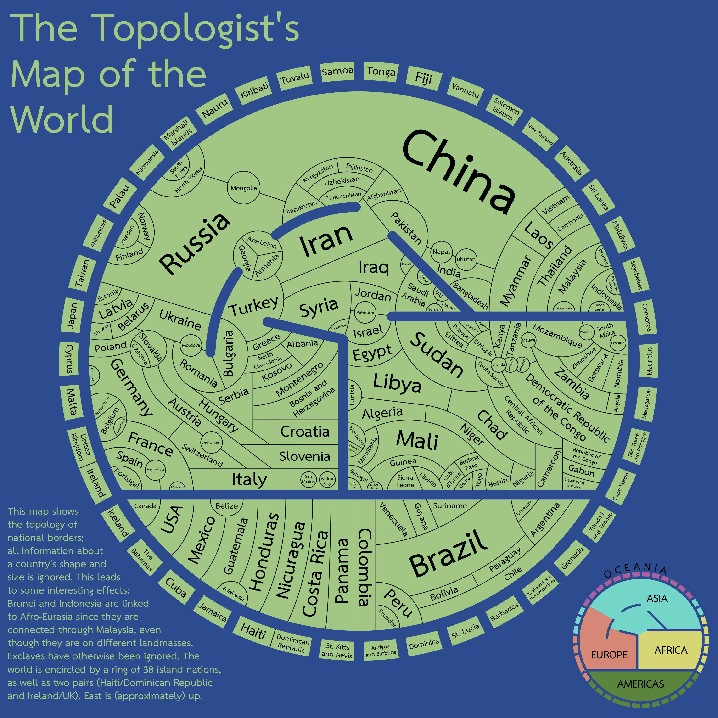
It made me think about that “maps only need 4 colors” (I don’t remember the proper name, but it’s an idea that maps with political borders can paint every state/country/whatever using 4 different colors and you’ll never get the same color bordering another), seems like the perfect opportunity to see if it applies here
East Africa and the Balkans took a little bit of figuring out
Edit: and sure enough, there’s actually a mistake in East Africa. DR Congo and Tanzania shouldn’t be the same colour. I think it can be fixed with the following changes:

It made me think about that “maps only need 4 colors” (I don’t remember the proper name, but it’s an idea that maps with political borders can paint every state/country/whatever using 4 different colors and you’ll never get the same color bordering another), seems like the perfect opportunity to see if it applies here
Here’s a way to do it https://i.imgur.com/YULx0sg.jpeg
East Africa and the Balkans took a little bit of figuring out
Edit: and sure enough, there’s actually a mistake in East Africa. DR Congo and Tanzania shouldn’t be the same colour. I think it can be fixed with the following changes: